Exploring the South Island—September 2022
New Zealand’s international border is now fully open for the first time since March 2020 and tourists are starting to come back. Anticipating a busy spring and summer, we decided to take an early spring trip down to the South Island.
We started in Christchurch where we picked up a rental car. This was our route:

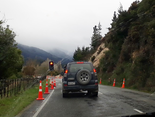
Our itinerary had changed in just the past week or so and was potentially subject to further change because the area we planned to visit had a massive rain storm with record rainfall in some areas. As a result, some areas were flooded and some of the main roads we planned to take were closed for several days due to slips. Fortunately, things were pretty much back to normal by the time we arrived although several smaller roads are still closed and there were several delays on our route as roads were down to one lane in some sections. And the locals had some wild stories.
We headed out of Christchurch toward the Southern Alps. It definitely still looked like winter.


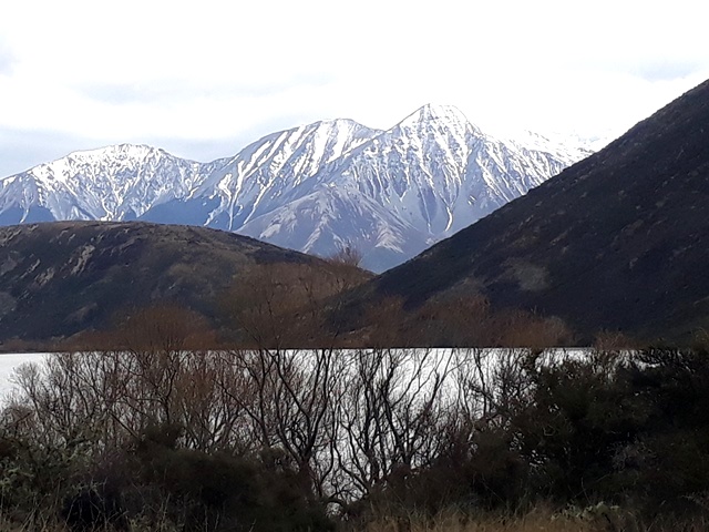
We crossed the Alps at Arthur’s Pass and headed to the west coast.

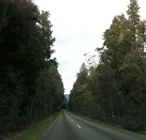
Once we got through the mountains, the scenery changed.
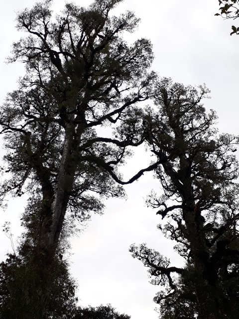
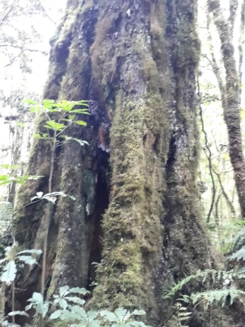
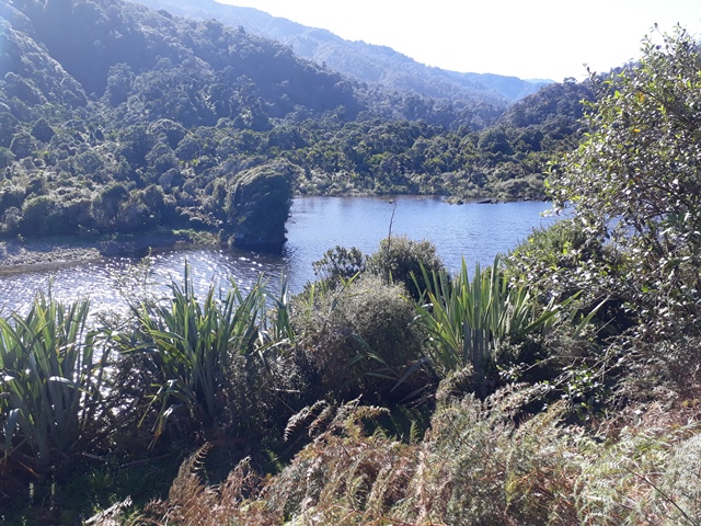
Our first stop was Lake Kaniere.

There is a nice wetland walk through a grove of very old kahikatea. Kahikatea are New Zealand’s tallest native trees, growing to up to 80 meters and living for several hundreds of years. We’ve been to Lake Kaniere before, but enjoy coming back as walking amongst these ancient trees is awe inspiring.

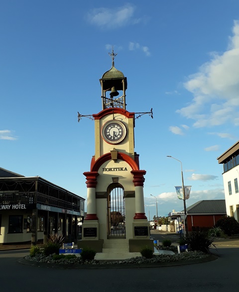
We spent our first night in Hokitika, a lovely little town on the west coast with a great beach.
We had a nice walk along the beach at sunset.

The next morning we drove up the west coast to Karamea, where we planned to spend the night and where the road literally stops. Most of the northwest corner of the South Island is taken up by the Kahurangi National Park and Karamea is at one end of the walkway that crosses the park.
On the drive up we passed through several towns. The largest was Greymouth where we stopped for a visit.

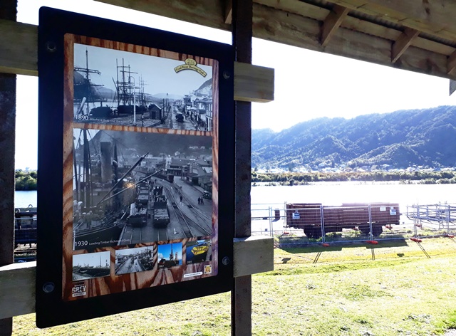
Greymouth was the centre of the New Zealand mining industry and with the decline in mining, the economy has shifted to ecotourism. However there are still a lot of reminders of the mining days with a Heritage Park along the river bank.
These are giant digging tools carved out of wood.

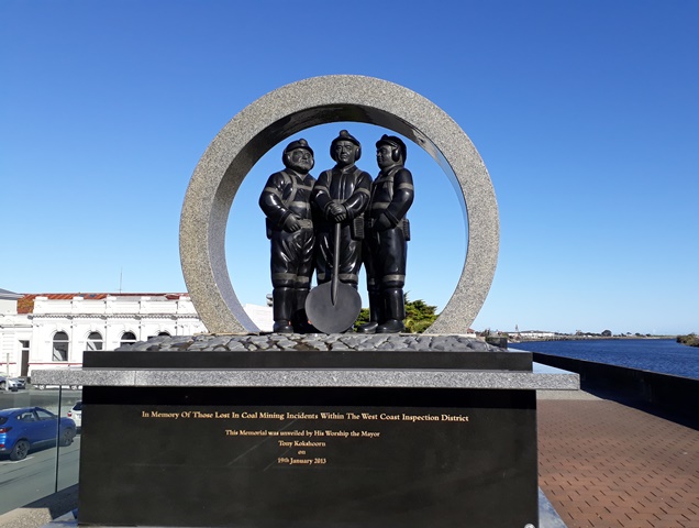
And this is a memorial to the numerous miners who lost their lives in the coal mines over the years.
We opted to take a detour from the coastal road to explore some interesting places a further inland. Our first stop about 30 kms away was a town called Blackball, population 230.
Amongst other things, Blackball is famous for its quaint hotel—the Blackball Hilton.

You may not be able to see it in the picture, but above the sign there is a little sign that says “Formerly.” The reason for that is because attorneys at Hilton Hotel, the global hotel chain, got wind of the fact that there was another hotel named “Hilton” that they didn’t own and feared that the existence of the Hilton in Blackball would be a threat to their brand, and possibly very survival.
Apparently tacking “Formerly” to the name satisfied the attorneys and the story of the little guy fighting the global capitalists is a good segue to more interesting aspects of the town’s history.
Blackball was a mining town in the late 19th and early 20th centuries. It became the centre of labour and union activism. The New Zealand Labour Party was started there and at one time it was the headquarters of the NZ Communist Party.
To be honest, there isn’t a lot of activism (or activity) in Blackball these days, but there is a museum that commemorates the town’s history.
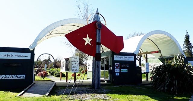
The museum has exhibits about labour activism and strikes as well as a memorial to workers killed on the job.

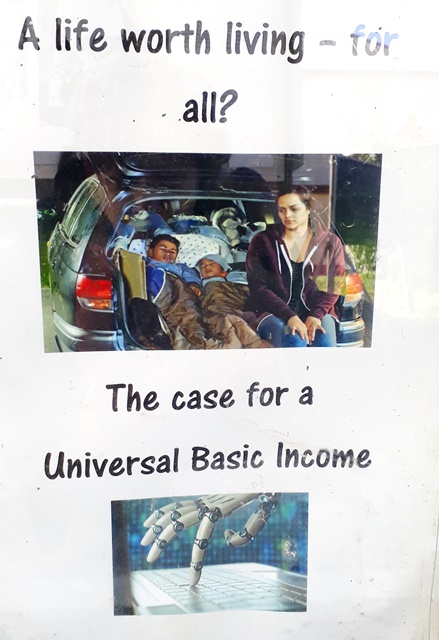
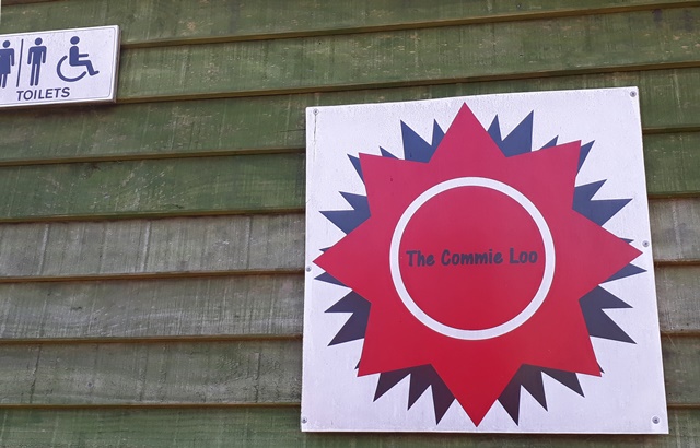
The activist philosophy is still prevalent in the area today!
It even shows up in the public toilets!
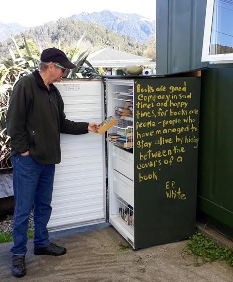
The public “library” is an old fridge.
From Blackball we drove to Reefton, and explored a nice little town famous for being the first place in New Zealand to get electricity.

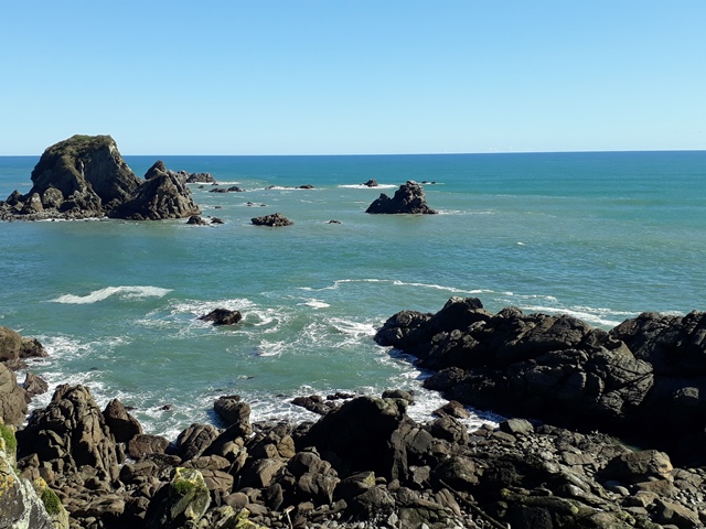
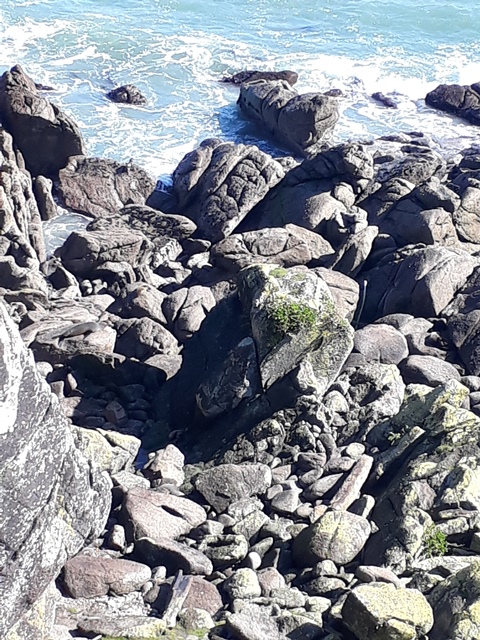
Heading back to the coast, we stopped at Cape Foulwind. The Cape got its name after Captain Cook referred to it as “The Place of Foul Winds.” A few years ago when we had driven here the area lived up to its name and we opted against walking to the light house and seal colony, but today it was Cape Nowind and there were also no other people!


Trust me, there are seals down on the rocks!
On the walk we also saw a lot of weka. They are native New Zealand birds and like kiwi they are flightless—but unlike kiwi, weka are plentiful, friendly and out during the day.

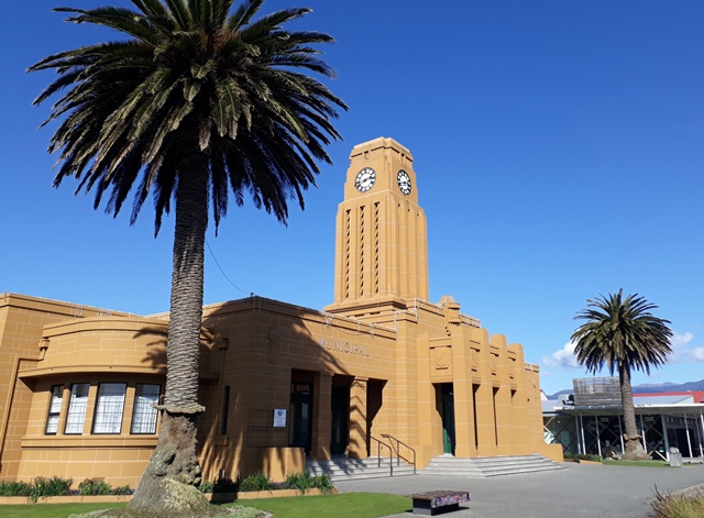
Before heading to Karamea we gassed up and spent some time exploring Westport, the last town of any size on the coast—and with a cool art deco city hall!
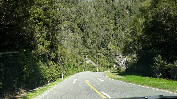
The drive to Karamea was both scenic and scary. There was a 20 kilometre section that was nonstop hairpin curves.
And a few one way bridges.

Once in Karamea, we checked in and went exploring. There is an interesting sculpture of a Maori warrior riding on the back of a huge eagle.
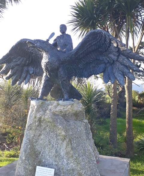
The sculpture is a representation of the Haast’s eagle which is an extinct eagle that had a wingspan of eight feet and a four inch beak. These eagles actually existed and there are legends of them flying off with little Maori children. Their primary prey was the moa which was like a 12 foot tall ostrich. The statue depicts Te Maia, a real person who according to the story actually explored the top of the South Island on the back of an eagle.
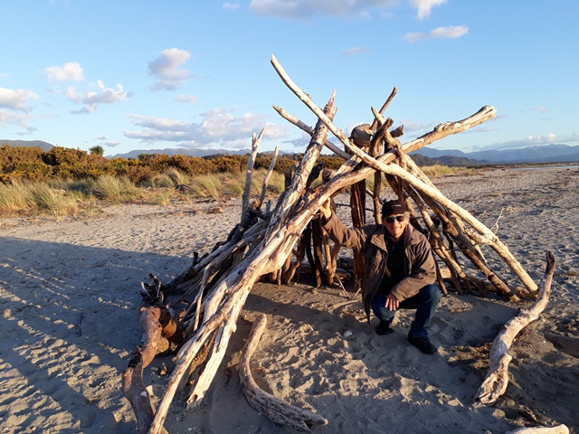
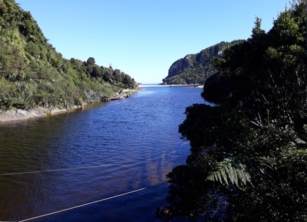
The Arapito River flows into the Tasman Sea at Karamea and we explored the estuary.


Local fishermen build these little huts for protection from the weather.
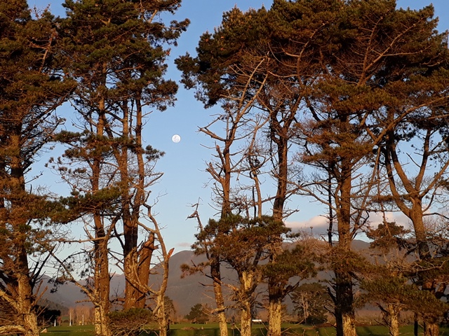
We’d hoped to see a lot of stars but there was a full moon!
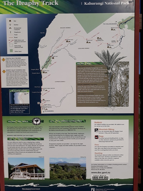
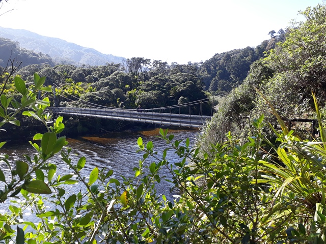
The next morning we drove up a few kilometers to the end of the road and explored part of the Heaphy Track which is one of New Zealand’s Great Walks. It is 78 kilometers long and takes 4-6 days to complete. The range is not only because people may walk at different rates—the weather is often so wild that the track becomes impassable and you have to wait it out.
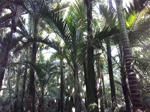
We just walked a tiny bit of the track on a beautiful sunny day. The start of the track runs along the Arapito River and then crosses the river into some beautiful native bush.

A lot of native birds up in the trees and wekas on the ground kept us company.

We did a short loop track and then followed the river to the beach.

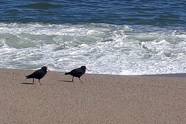
The beach was deserted except for some oystercatchers.
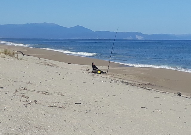
And a lone fisherman.
I tried out the local shelter!

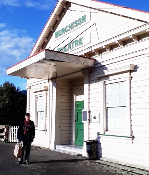
After a few hours exploring, we headed back to Karamea and then continued to our next stop, Murchison.
We returned over the same curvy roads and this time focused more on enjoying the amazing views.

We passed through the small town of Granity. Here is the library:

We turned east and followed the Buller River toward Murchison.

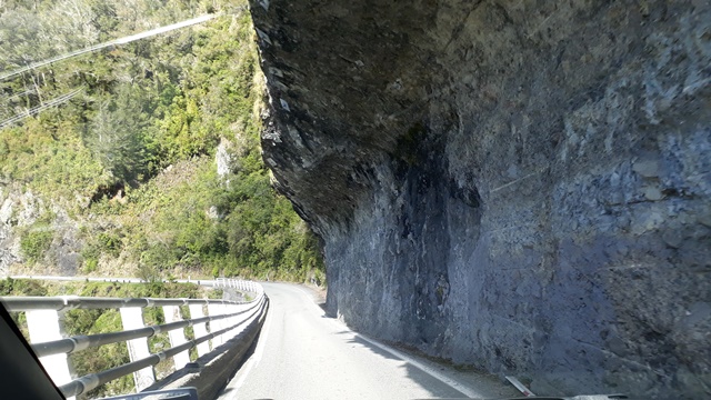
And encountered some interesting road sections!

Murchison is a town of about 700 and because it is located near four rivers, it is a popular spot for water sports, including white water rafting.
However we were the only people at the place we were staying. Check in was by remote control and we never met the host—you just get the key and self-serve!

We spent a quiet evening exploring the area.

Queen Elizabeth II had just died a couple of days ago so all flags were at half-mast and most places were closed.

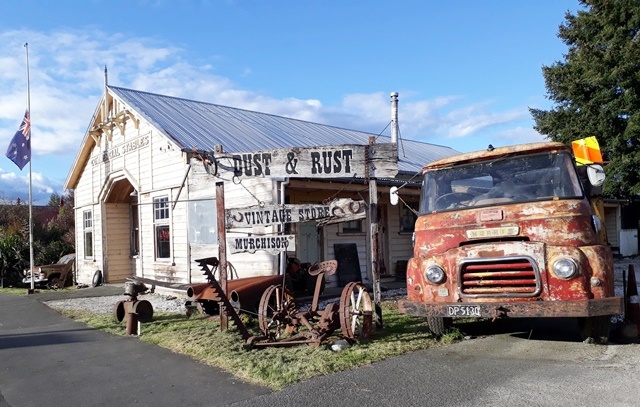
We would have loved to check out this unique shop, but it was closed too.
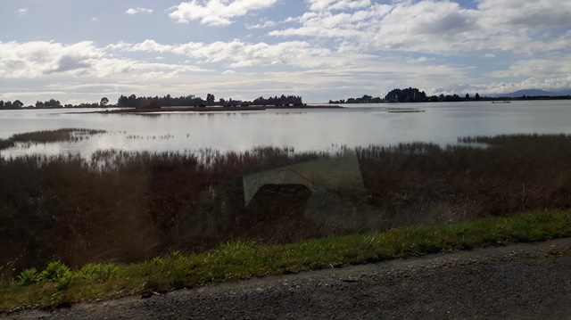
The next morning we started our drive north. We weren’t sure what to expect because we were heading to the spots where there had been flood damage and although the roads were open, some were under repair.
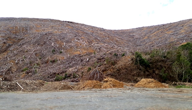
Several of the slips were the result of harvesting pine forests along the route. When the pines are cut down, there is nothing to hold the soil in place during heavy rain.
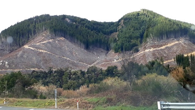
This is what happens:
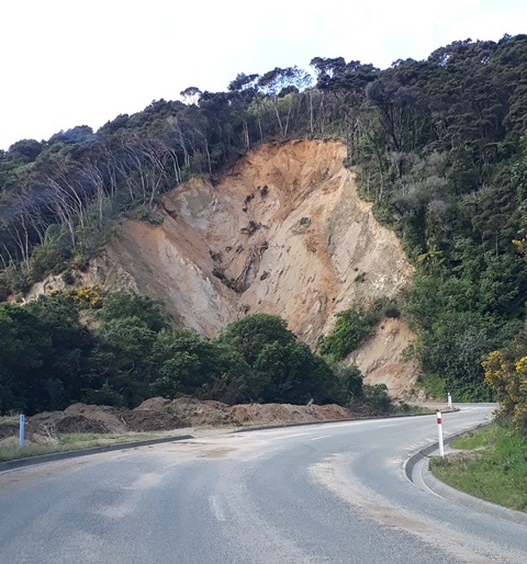
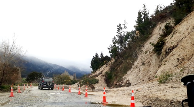
Fortunately there weren’t many of these slips and we headed up to Pohara, our destination on the ‘north coast’ of the South Island.
To reach Pohara we drove through parts of the Kahurangi National Park and the gateway to the park was marked by an information site in a Waharoa (native garden). The big rock in the centre was dislodged from the nearby mountain and is the Kaitiaki (Guardian Rock), protecting nature and all those who travel through it.

We passed through Motueka, a good sized town of about 8,000 on Tasman Bay.

We have been to Motueka a few times and the highlight is the Sunday market, historically a fascinating and eclectic place with lots of interesting characters.
We got to town and went to the market but were a bit disappointed at how small and empty it was compared to previous visits.

Half of the fun of the Motueka market is talking to the stall operators about their interesting goods and we mentioned to a couple of them that things seemed different. Sadly, a rift arose over whether the market should have a mask mandate during Covid. Anti-mask stall operators decided to split off and form their own market which is held in a different town. Even so, the market was vibrant and fun and we bought some fantastic local produce.
We continued on to Pohara, which is also on the Tasman Bay and checked into our cabin for the next two nights. The campground was virtually empty and our cabin was right on the beach.


It was still a relatively full moon and that meant the tide was especially high making for strong waves as the tide came in. Each night for a few minutes each side of high tide we were woken up by the shaking and rattling of the cabin.
After we got settled in we explored the area around Pohara.
Our first stop was Te Waikoropupu Springs, which are considered very sacred by the local Maori. It is a huge underground spring and the water is among the cleanest in the world with visibility up to 63 metres (207 feet).

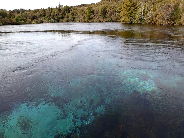
They have a lovely walk through the native bush along the stream that flows out of the spring.

We also explored The Grove, which is a forest growing around some very large rocks.


The area has many beautiful bays and beaches and it was great exploring them. With no people around we had them to ourselves.

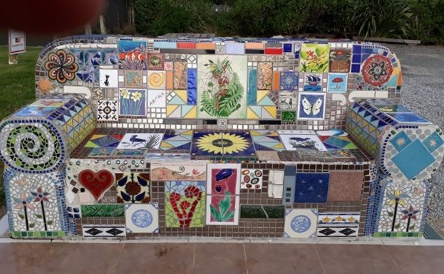
At Tata Beach we saw this interesting bench which had been created in memory of a departed well loved member of the local community.
The next morning we planned to head west and explore Farewell Spit which is the extreme northwest corner of the South Island. Unfortunately, it was the only day it rained and the rain reduced visibility (and the desirability of exploring). As we had been to Farewell Spit on our previous trip here, we just drove to the base of the spit and then headed to Collingwood, the last settlement of any size on the coast.

It would be an understatement to say that Collingwood is a slightly eccentric place and you can see interesting things as you walk down the main street. For example, a Japanese tori gate at the King’s Arms.

And a shop that forbids cell phones.
And the amazing Mad Theartre cafe.

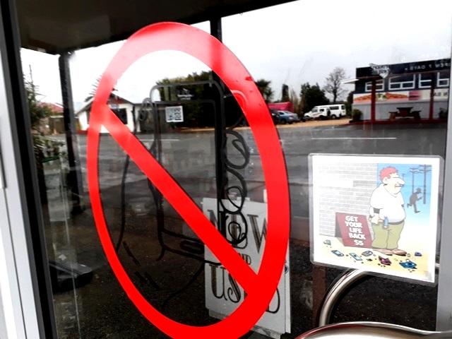
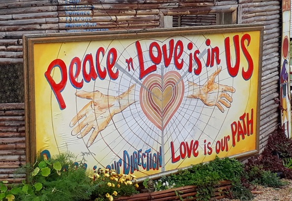
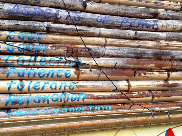
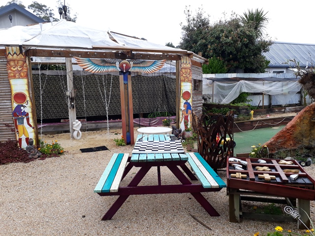
Adjacent to the Mad Theartre is a public space that is truly interesting. Although you have to love the philosophy behind the space, it’s also very much on the fringe.
It also includes the New Zeal chapel (unfortunately closed) where you can walk the path of the snake and be reborn.
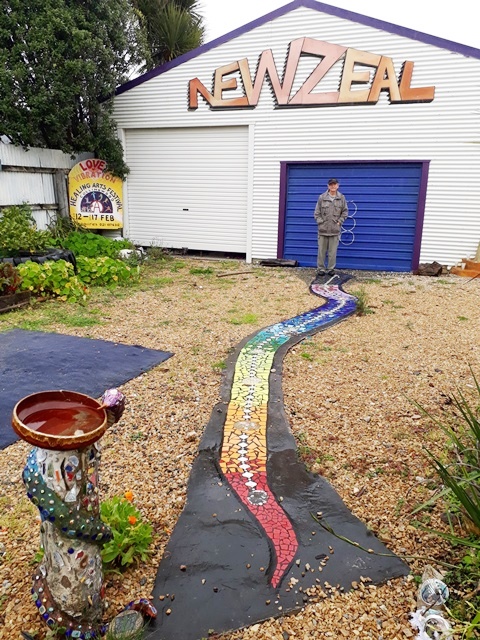
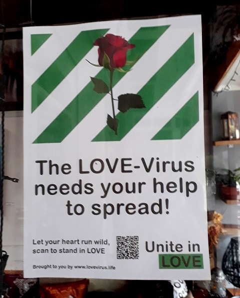
It also reflects the antivax sentiments of the manager.

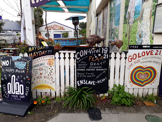

Which is at least tempered with some very positive sentiments.

While Mahrukh took pictures, I chatted with the manager who was a pleasant, engaging person and very diplomatic—neither of us were interested in a debate but instead discussed the positive energy that the community space generated. It was an interesting visit but only made the whole issue of how Covid has affected us as a society more complicated in my mind.
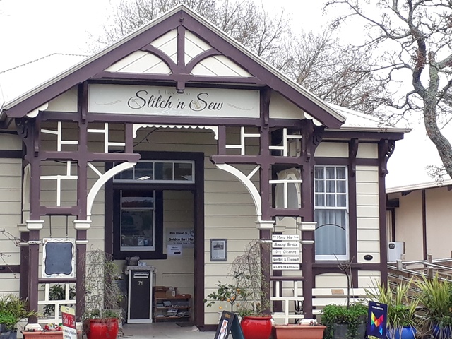
We left Collingwood and headed to Takaka, the nearest big town in what is called Golden Bay only about 10 minutes from Pohara where we were staying. Takaka is a lovely, quaint town with lots of interesting residents who are willing to have a chat about just about anything.
We explored some of the interesting shops.
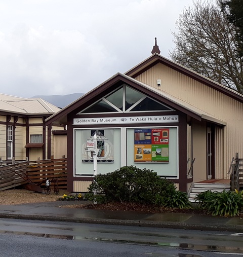
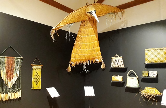
We visited the Golden Bay museum. The original name for Golden Bay was Massacre Bay because of an altercation that occurred between Abel Tasman’s crew and the local Maori. The museum exhibits were an interesting mix of local history and arts and crafts and even a model recreating the event.

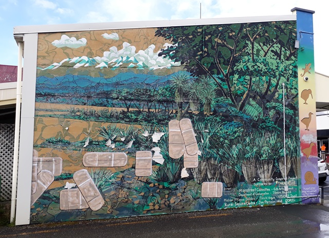
Takaka has interesting street art.
This wall mural was beginning to fade and crack. The artist couldn’t raise funds to fix it so he painted plasters over the bad spots. That generated enough interest to raise money to repair the mural and according to locals it will be fixed this summer.
By evening the weather had cleared up so we explored more of the Tasman Bay. There was another interesting road.
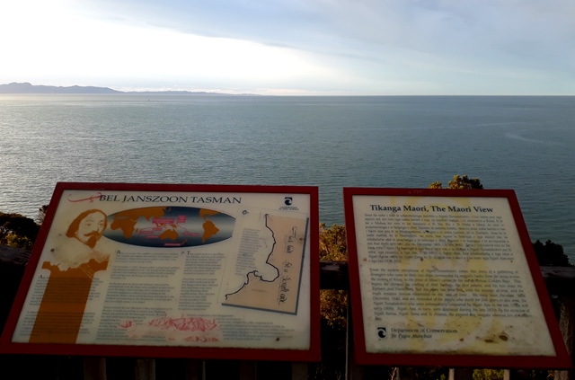
We visited the Abel Tasman memorial which commemorates the “discovery” of New Zealand in December 1642. The memorial has signs describing both the Dutch and the Māori views of events of the day.
We had to climb a big hill to reach the monument but the view was worth it.

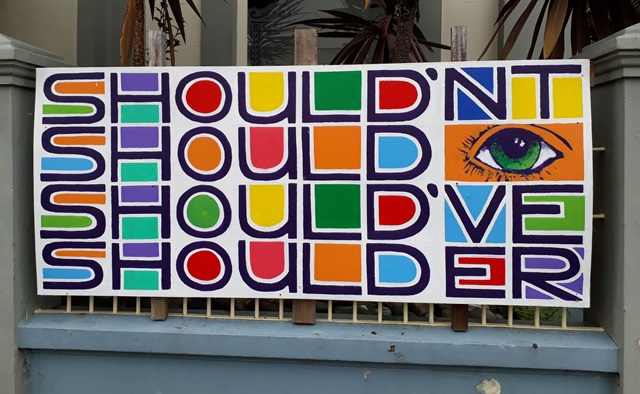
We then drove back to Takaka and decided that fish and chips was the only option for dinner!

The sign at the fish and chip shop had some good advice!

The next morning we left Pohara for Picton and the Marlborough Sounds. We drove back down the winding Takaka Hills through Mouteka and along the various bays on to Nelson.


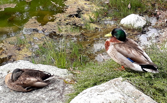
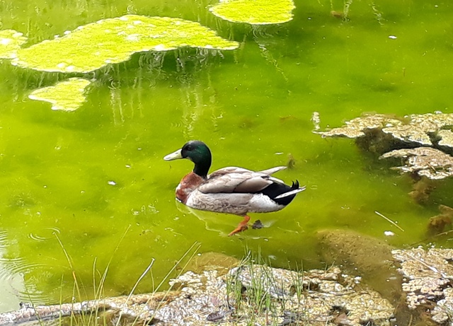
In Nelson we had a leisurely visit at the Miyazu Japanese Garden. The cherry blossoms were just starting to bloom.
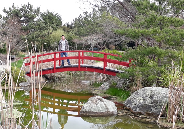
Except for some feathered friends we had the peaceful gardens to ourselves.
We then continued on toward Picton along a road that had been closed for the past several weeks after the heavy rain. There had been a lot of slips and a lot of logging in the area.
We enjoyed the irony of waiting for a log truck at one of the slip sites.

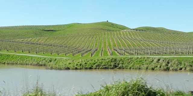
Once we got out of the hills we were in Marlborough wine country.
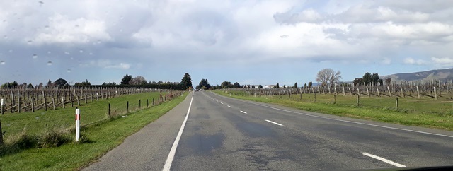
Before reaching Picton, we passed through Blenheim, the largest town in Marlborough with a population of 28,000. It is a vibrant, spotless town and we spent a few hours walking around and exploring.

And of course we had to love a town with an upmarket department store like this!

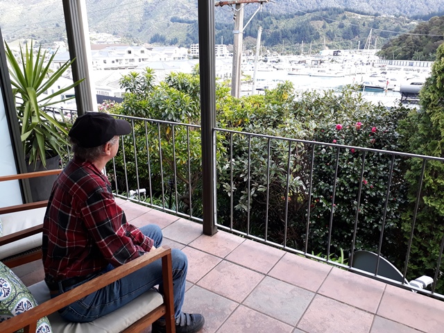
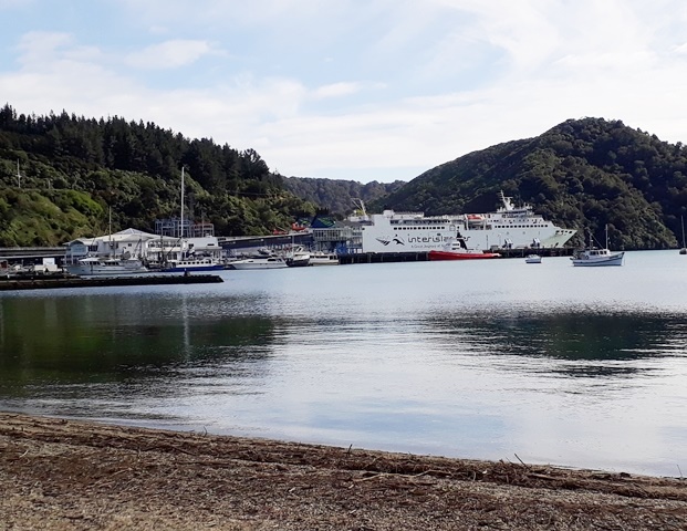
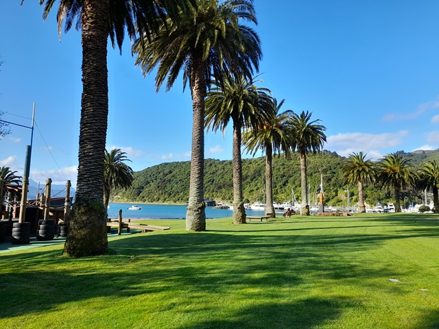
We then headed up to Picton, about half an hour north. After checking into our accomodation overlooking the marina, we headed out to explore.
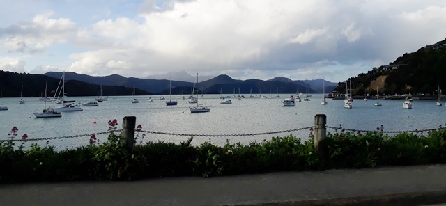
The big ship is the Interislander ferry which runs between Picton and Wellington and connects the North and South Islands.
The next morning we visited the Kaipupu Wildlife Sanctuary which is managed by the Department of Conservation. It is on a peninsula and there is a 600 metre long predator proof fence protecting it from the mainland. You can’t go through the fence, so the only access is by water.
You have to arrange your own transport and we booked a water taxi. They agreed to take us out and come back in two hours to pick us up.
It was a short ride to the dock and when we got there a seal was waiting for us.


The boat left and I had a strong sense of isolation. I was expecting a visitors center and guides, but the only thing was the dock, a welcome sign and an arrow pointing to the walking track. Not only that, we were the only people there and it felt rather special. The walking track is a big circle around the peninsula—so at least you can’t get lost!
We really enjoyed the peace and quiet and lots of birds as we took a very leisurely walk around the reserve. The kowhai were also in bloom.

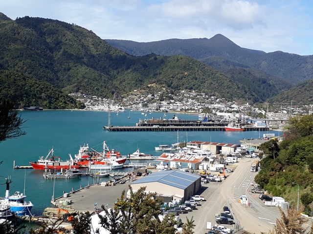
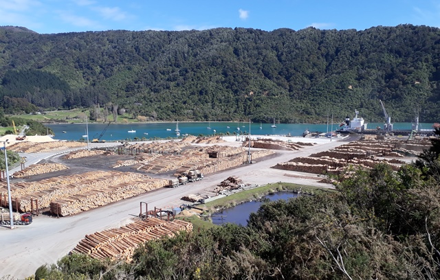
From the predator fence you look out over the port and the town.
Recently harvested pine logs waited to be shipped overseas.

Fortunately the view of the beautiful Marlborough Sounds from other the end of the peninsular is more appealing.

We walked back to the dock and found the seals had come back.

The boat returned right on time and we headed back to Picton.

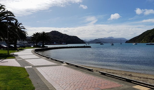
We spent the afternoon doing various activities in the area by the harbour.

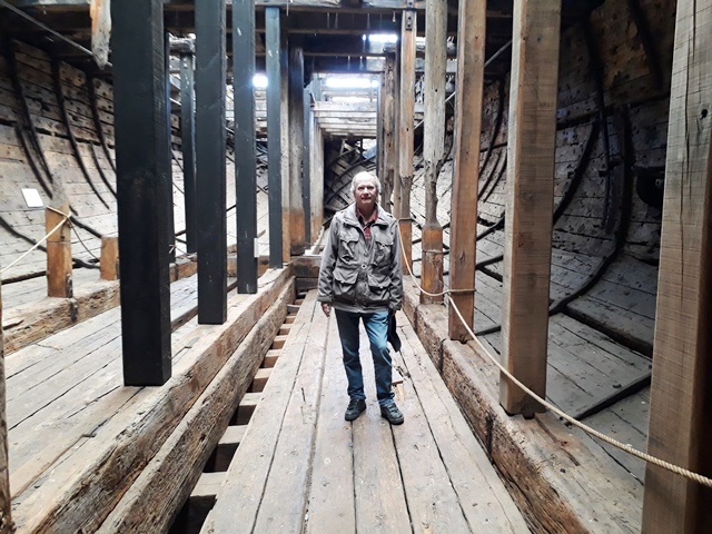
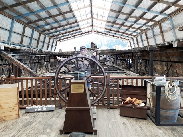
We also went to the Edwin Fox Maritime Museum where they have the actual original ship. The Edwin Fox, built in India in 1853, had been used to bring convict labour from England to Australia and also to bring English settlers to New Zealand. The ship was used as a floating storehouse for many years after its sailing days were over and it gradually started to fall apart.
In the 1970s the ship was rescued and turned into a museum exhibit. You can actually walk onto the ship and there are exhibits about what life on board was like.
The next morning we started on our last leg of the trip—back to Christchurch via Kaikoura. We headed south and passed through Blenheim on the way. As we left town we spotted two hitchhikers heading for Kaikoura so we picked them up. They were a young couple from France on a three month exploration of New Zealand.
The drive is one of the most beautiful in New Zealand. You start out in Marlborough wine country.
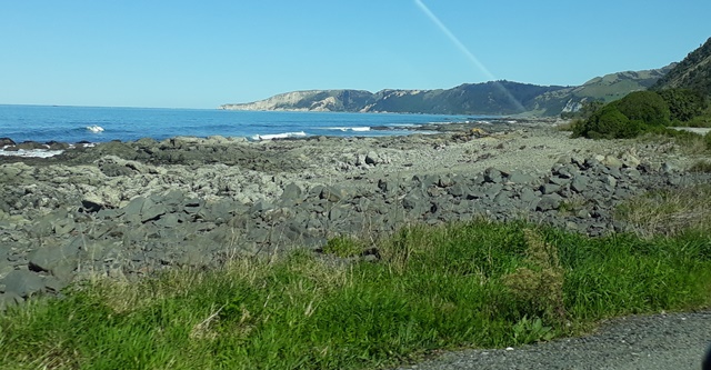
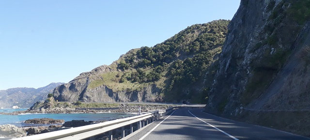
After Blenheim, the road runs along the coast and you have the ocean on one side and the mountains on the other.
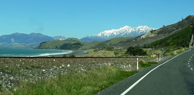

In 2016, there was a massive earthquake in Kaikoura (we even felt in in Auckland) and although fortunately there was little loss of life, there was significant geological and ecological disruption. In some areas, the Kaikoura coast was lifted up to six meters and you can see evidence of that along the way.

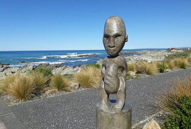
Local Maori artists have enhanced some of the lovely pullouts with artwork and sculptures.


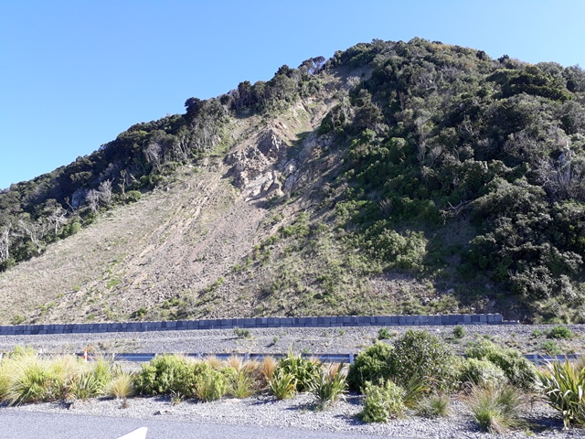
The road we were driving on was closed for over a year as crews worked to clear slips and reconstruct the road where it had disappeared and you can still see scars of some of the slips.
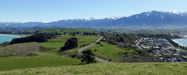
We dropped our hitchhikers in Kaikoura and did a little exploring of the town. We drove to a viewpoint at the end of the Kaikoura peninsula and had a panoramic view of the town and surrounding areas.
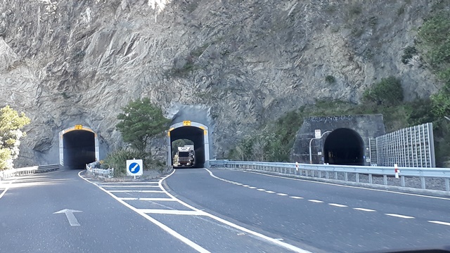
We continued on to Christchurch, and along the road you could see the effects of the earthquake. It is not too visible in the photos but they have put big netting on the hill sides to prevent the continuing rock falls from hitting passing cars.

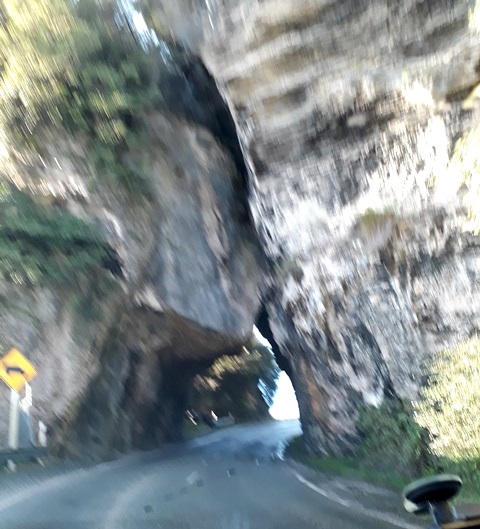
And went through a cool tunnel. The third tunnel is for the Coastal Pacific scenic train that runs from Picton to Christchurch. We had done the trip several years ago and it is a spectacular ride.
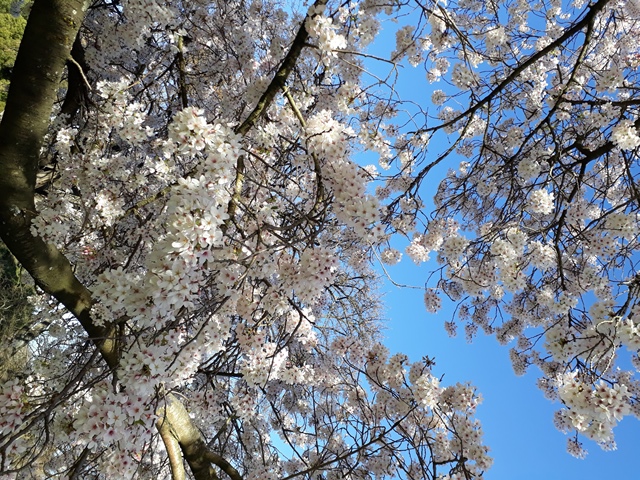
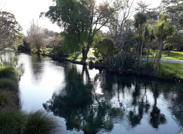
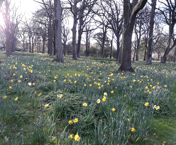
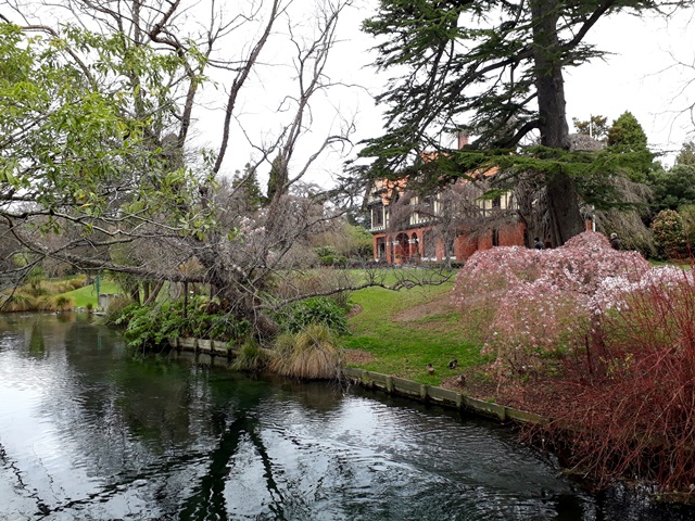
We arrived in Christchurch in the late afternoon and checked in to our B&B. Christchurch is New Zealand’s second largest city and has the nickname “The Garden City,” because there are so many parks. The largest, which is right in the central city is Hagley Park and our accommodation was a ten minute walk from one of the park entrances. We decided to walk through the park to the city center and were hoping to see cherry blossoms in bloom and we weren’t disappointed.

The Avon River flows through the park.

We got into town (after spending a lot longer exploring Hagley Park than we anticipated) and had dinner and headed back at sunset – tired after having walked almost 10 kms!!

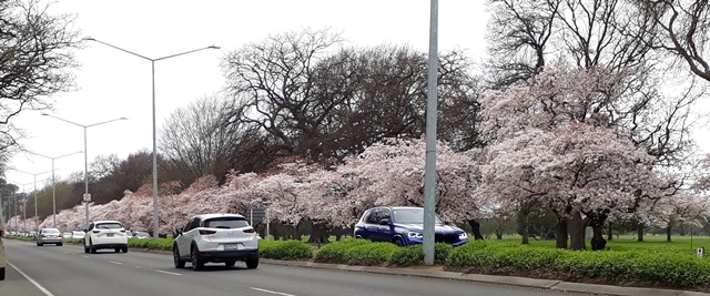
The next morning we drove into town to explore. We saw more cherry blossoms.
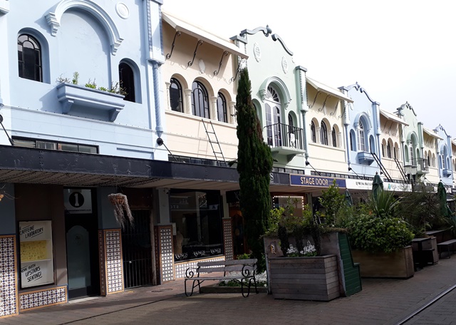
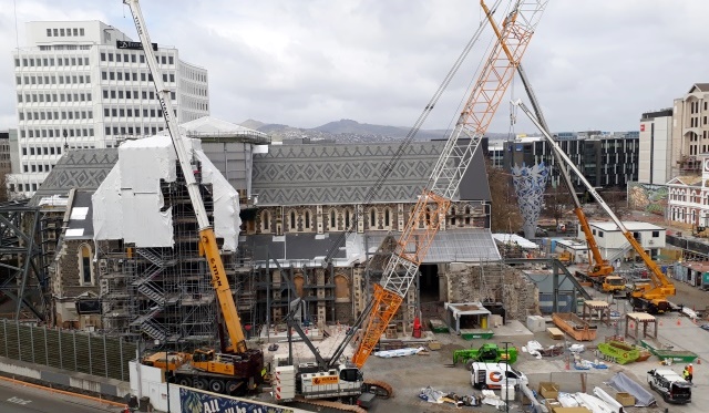
We parked in town and went for a walk, exploring the central city which has changed dramatically since most of it was destroyed in the big 2010 and 2011 earthquakes. Fortunately they have been able to restore some of the heritage buildings.

The Christchurch cathedral, which was badly damaged in the 2011 earthquake, is finally being restored. There has been a lot of discussion at the local, national levels and with the church body about whether to restore it or rebuild it and who should pay for it. According to the news, the first task when the rebuild started was for people in hazmat suits to go in and clean out ten years’ worth of bird poop which would have been a health hazard for the workers.

We also spotted this must visit restaurant!

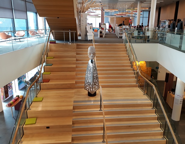
We visited the new state of the art city library and ended up spending almost three hours there!! There was something interesting on every floor and lots of friendly staff to talk to.
We then went visited our friend Janet who lives in the Port Hills section of Christchurch. They are named the Port Hills because they separate Christchurch from its port in Lyttleton Harbour.
After a nice lunch, Janet took us on a tour of the Port Hills area.

We got to the top of the road and went for a walk. There are some old teahouses on the road that connected Christchurch with the bay and two of them are still used as cafes. The smallest and furthest from town is now just a ruin.

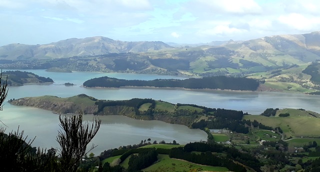
And at the summit there are some great views of Lyttleton Harbour.

After the walk, we headed back to town and explored a couple more parks and reserves.
The next morning, we packed up and headed to the airport for our flight back to Auckland with lots of memories of a great trip!